Quick answer
Checked September 2026.
The best walk in old Chongqing fits into one day, in three parts. In the morning, walk from Qixinggang down the Mountain City Trail to Shancheng Lane, then walk Shibati. In the afternoon, go up onto Dongshuimen Bridge from the Huguang Guild Hall and walk across the Yangtze to Xiahaoli and Longmenhao Old Street on the south bank. Stay until the lights come on at dusk. In the evening, follow the Two Rivers riverside walkway to Chaotianmen to see the two rivers meet, then on to Hongya Cave. The whole way is on free lanes and walkways (the Huguang Guild Hall charges for entry). All of it adds up to about 12 kilometres on the flat. Between parts you can take a car or the metro, and you can walk any part on its own.
- Order matters: always walk the Mountain City Trail downhill, from the Qixinggang end. To walk Shibati downhill only, go in at the top entrance at Jiaochangkou. The other way round, it is uphill all the way.
- Only half a day: walk just the first part (the Mountain City Trail and Shibati), about 3 hours.
- The Shibati area is busiest from afternoon to late night, so walk the stepped part in the morning.
Put this route into your private trip: tell us your dates, how many of you there are and whose knees are not good. We swap the uphill parts for the car as far as we can, and the car and a licensed English-speaking guide go with you. WhatsApp us
How this page fits with how to get around Chongqing, the 3D city: that page explains why distances on the map don't count and which level to be dropped at, and it has two short routes. This page takes the short route along the Yangtze, adds the Mountain City Trail before it and the river crossing and Chaotianmen after it, and makes a full day.
How does the route work? Three parts in one table
The route starts high on the southern slope of the Yuzhong peninsula and heads down to the Yangtze, crosses to the south bank, then follows the river back to Chaotianmen at the tip of the peninsula. The morning part has the most steps, so walk it downhill. The afternoon part is a bridge and old streets. The evening part is a flat riverside walkway. Each part takes 1.5 to 3 hours, with time left between them for meals and the car. Unless a source is given, the distances below are flat-ground walking estimates from open-source maps. Chongqing has slopes and steps, so allow a few extra minutes for each part.
| Part | From and to | About how far, how long | Uphill or downhill | Best time | On to the next part |
|---|---|---|---|---|---|
| ① Mountain City Trail and Shibati | Qixinggang station (Lines 1 and 10) → Lingshi Lane → Mountain City Trail → Shancheng Lane → Shibati → Houci Street | The trail is 1,748 metres long. With stops to look around, the timetable allows nearly two hours. From the end of the trail to Shibati is about 7–8 minutes. Shibati from Jiaochangkou to Houci Street is about 800 metres. | The Mountain City Trail is downhill all the way. Shibati depends on which end you go in (see below). | Morning | Take a car from Houci Street to the Huguang Guild Hall. Or follow the Yangtze-side route in how to get around Chongqing, past the Kaixuan Road Lift and Baixiangju. |
| ② Across the Yangtze | Huguang Guild Hall → lift up to Dongshuimen Bridge → walk across the river → Xiahaoli and Longmenhao Old Street | Huguang Guild Hall to Xiahaoli is about 1.9 kilometres, about 25 minutes on the flat (bridge included). The two old streets are side by side. | The bridge is flat. Walk the two old streets from the top down. | Afternoon to dusk | Walk back over the bridge, or take Line 6 from Shangxinjie back to Xiaoshizi (one stop), or ride the Yangtze River Cableway back to the north bank. |
| ③ Riverside walkway to Chaotianmen | Huguang Guild Hall → Two Rivers riverside walkway → Chaotianmen Square → Hongya Cave → Daijiaxiang Cliff Walkway | The riverside walkway is about 2.4 kilometres long and links Hongya Cave, Chaotianmen and the Huguang Guild Hall. Walking it takes a little over 20 minutes. Hongya Cave 1st floor to Chaotianmen is about 1.3 kilometres. | The riverside walkway is flat. The Daijiaxiang Cliff Walkway at the end is uphill, a climb of about 60 metres. | Evening | The top of Daijiaxiang is by the Jiefangbei area. Take the car back to your hotel. |
Of the three parts, only the Huguang Guild Hall, the Yangtze River Cableway and the Raffles City Exploration Deck charge for entry. Everything else is open lanes and walkways. For tickets and booking, see Chongqing attraction tickets and booking.
Which end of the Mountain City Trail do you start from, and how long does it take?
Start at the top and walk down. Mountain City Trail No. 3 is on the southern slope of the Yuzhong peninsula, facing the Yangtze. It is 1,748 metres long. The highest point is near the Puti Vajra Pagoda and the lowest is the Shancheng Lane entrance, 79.5 metres lower. The easier way is to take Line 1 or Line 10 to Qixinggang station, come out of Exit 1 and enter the trail by Lingshi Lane (Consulate Lane), then walk downhill all the way to Shancheng Lane. With time to look around and take photos, allow one and a half to two hours. Going the other way, from Shancheng Lane up, is uphill all the way.
What to see on this part:
- The cliff walkway: a plank walkway built on a steep rock face. Yuzhong District calls it the only city walkway in Chongqing built on a cliff, with the Yangtze across from it. It is on the northern half of the trail. If you want to walk this part, tell your guide, and the guide picks the entrance to suit your energy.
- The old city wall: beside the cliff walkway is Chongqing's old city wall. Yuzhong District describes it as more than 2,300 years old.
- Ren'ai Tang: a group of church buildings put up by French missionaries in 1900. After more than 600 days of restoration, it became a hotel and restaurants in 2025. The church and the bell tower are still there.
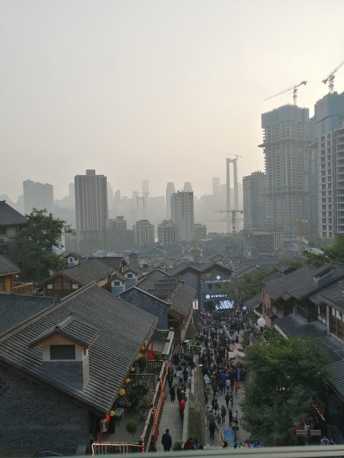
- Shancheng Lane: the lower half of the trail. Old houses, huangge fig trees, residents sitting in the shade, and teahouses and snack shops along the stone steps.
The trail is free and open all day. There are a lot of stone steps, so wear flat shoes with good grip.
Is Shibati worth it? Is it an old street or a new one?
Yes, but know that it was rebuilt in 2021. Shibati is one of the oldest streets in central Chongqing. It runs from Jiaochangkou at the top to Houci Street at the bottom, and it used to be the way between the upper and lower town. Work began in 2017, and it reopened just before National Day 2021. The layout of "seven streets and six lanes", the old stone steps, the old trees and the retaining walls were kept, but most of the houses on either side are new. The line of the steps is old, and the houses are new. We say this first so you are not surprised by how new it looks.
- How long: the stepped street is about 400 metres long, with more than 200 steps. From Jiaochangkou down to Houci Street is about 800 metres, about 11 minutes on the flat.
- Where to go in: Jiaochangkou station on Metro Lines 1 and 2. Exits 3, 4 and 11 all lead there. The top entrance is at the "City Balcony" at Jiaochangkou, where you can first look out over the roofs of the whole of Shibati.
- What to see: the main old stone stairway, a little over 100 metres, running down from the City Balcony. The set from the film I Belonged to You has been kept. And the old-street things are all here: covered-bowl tea, opera and sugar painting.
- Free, no booking, open all day.
- To see how Chongqing people shop for food: the Shihuishi market near Jiaochangkou is a real local food market. It is busiest in the morning, and there is no ticket. If you want to go, put it first in your day, then walk the Mountain City Trail.
Coming out of Shancheng Lane on foot, you reach the lower half of Shibati, so heading to Jiaochangkou is uphill. That gives two ways to join it to the Mountain City Trail:
- Good legs: go in at the lower half, walk up to the City Balcony at Jiaochangkou, then come back down the same way to Houci Street.
- Downhill only: get in the car at the Shancheng Lane exit and be dropped at the top entrance at Jiaochangkou. Walk down from the City Balcony to Houci Street, and get back in the car there. It is the same as "Shibati: down only" in how to get around Chongqing. If your knees are not good, choose this one.
How do you get from Shibati to the Huguang Guild Hall and Dongshuimen Bridge?
Two ways. To walk less: take a car from Houci Street, a few minutes to the Huguang Guild Hall. To keep walking: head east through the lower town, past the Kaixuan Road Lift and Baixiangju, to the Huguang Guild Hall. The Yangtze-side route in how to get around Chongqing covers this stretch in detail (down through Baixiangju to the Yangtze riverfront road, then about 550 metres to the Huguang Guild Hall). Baixiangju is a 24-storey residential block with no lift. Walk it from the top down. See Kuixinglou and Baixiangju.
The Huguang Guild Hall is on Changbin Road. The name covers a group of Qing-dynasty guild hall buildings, including Yuwang Palace, the Qi'an Guild and the Guangdong Guild, on a site of about 18,400 square metres. In 2006 it was listed as a major historical and cultural site protected at the national level. There is a charge to go in. If you want to see Sichuan opera face-changing, you can add a show here. Shibati was rebuilt, and the Huguang Guild Hall is old buildings that survived, so seeing one after the other makes a good contrast.
Can you walk across the Yangtze on Dongshuimen Bridge? How long does it take?
Yes. The Dongshuimen Yangtze River Bridge has a vertical lift at each end: the north one beside the Huguang Guild Hall in Yuzhong District, the south one beside Longmenhao Old Street in Nan'an District. They opened in November 2022, to make it easier for people to get up onto the bridge and walk across the river. Go by the notice on site for the lifts' daily hours. On the day we walk with you, we check before setting off. Take the lift up from the Huguang Guild Hall, walk across the Yangtze on the bridge footpath, then take the lift down at the south end to Nanbin Road. To Xiahaoli is about 1.9 kilometres, about 25 minutes on the flat.
What to see from the bridge: behind you, the towers of the Yuzhong peninsula and the roofs of the Huguang Guild Hall. Downstream, Chaotianmen and Raffles City. Upstream, the Yangtze River Cableway cabins going back and forth.
If you don't want to walk back: take Line 6 from Shangxinjie station, next to Xiahaoli, back to Xiaoshizi, one stop. Or ride the Yangtze River Cableway back to the north bank (for fares, opening hours and the one maintenance day a month, see our Yangtze River Cableway guide).
What is there at Xiahaoli and Longmenhao Old Street? When is the best time to go?
The two old streets are side by side, both below the south end of Dongshuimen Bridge on the Nan'an side, facing the Yuzhong peninsula. Longmenhao was the wharf and foreign trading-house area when Chongqing opened as a treaty port. Old buildings mixing Chinese and Western styles remain there: the French Yongxing trading house, the Belgian consulate, the US Embassy military attaché's office and the former Wuchang Zhonghua University. Xiahaoli is the stretch of old streets just downstream (once called Lower Longmenhao). Work started in 2021, on the rule of "same site, same footprint, same height, same look", and more than 70 buildings were restored. It opened in November 2022, and today it is steps, old houses, cafés and small shops. The best time is early evening: see the old buildings while it is still light, and at dusk the whole area lights up, along with the towers of the Yuzhong peninsula across the river.
- Getting there: walk across Dongshuimen Bridge (see above), or take Metro Line 6 or the Loop Line to Shangxinjie station.
- The easy way round: go in at the entrance at the Shangxinjie station end and walk downhill all the way. Xiahaoli has a lot of alleys and it is easy to go round in circles, so follow your guide or the map.
- How long: to see both streets and then have dinner on the south bank, the timetable allows two and a half hours.
- No entrance fee. Shops and restaurants charge as normal.
- Longmenhao Old Street is a national-level cluster for night-time culture and tourism spending, so weekend evenings are busy. To take photos, get there early.
If you want to go on up Nanshan for the panorama, it is closest from here. See Nanshan viewpoints in half a day.
How do you walk to Chaotianmen? Where do you see the two rivers meet?
Walk downstream along the river from the Huguang Guild Hall. In December 2025, Chaotianmen Square and the Two Rivers riverside walkway reopened. This waterside walkway is about 2.4 kilometres long and links Hongya Cave, Chaotianmen and the Huguang Guild Hall. It takes a little over 20 minutes to walk, and there are benches along the way. From the river viewing platform at Chaotianmen you can see the Yangtze and the Jialing meet, one yellow and one green, with a clear line between them. Dongshuimen Bridge and Qiansimen Bridge are both in front of you.
- Chaotianmen Square is free. To look down on the meeting of the rivers from high up, go to the Exploration Deck at Raffles City behind the square (there is a charge; see our Raffles City Exploration Deck guide).
- Metro: Chaotianmen station is on Line 1 only, at the end of the line.
- Chaotianmen is also the pier where Three Gorges cruises board. If you are taking a cruise, you can fit this part in before you board (see boarding a Yangtze cruise in Chongqing).
- Two Rivers night cruises board at three piers: one kind at Hongya Cave pier, the other two at Chaotianmen pier. Check which one your ticket says (see our Two Rivers night cruise guide).
How do you finish the evening? Hongya Cave and the Daijiaxiang Cliff Walkway
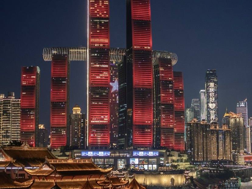
From Chaotianmen, follow the riverside walkway up the Jialing River for about 1.3 kilometres to Hongya Cave. For when the lights come on and which floor to go in, see our Hongya Cave guide. When you are done, don't go back the way you came. Right next to Hongya Cave is the Daijiaxiang Cliff Walkway. Its bottom entrance is about 50 metres from the Hongya Cave car park entrance on the riverside road, towards the No. 1 Bridge. The walkway is about 750 metres long with a climb of nearly 60 metres, in several Z-shaped turns up the cliff. Along the way are stilted houses, huangge fig trees and a stretch of city wall, with views of Qiansimen Bridge, Jiangbeizui and the Jialing River. At a quick pace it takes about 8 minutes to reach the top. Up there is the old Daijiaxiang neighbourhood, with a row of cafés and small shops, and above that is the Jiefangbei area.
- Daijiaxiang is uphill. If you don't want to climb: take the sightseeing lift inside Hongya Cave back up to the upper level, or get in the car below Hongya Cave.
- On public-holiday evenings, roads around Hongya Cave are under temporary traffic control and cars can't get to the door, so the pickup point has to change. See how to get around Chongqing.
How do you plan the day, hour by hour?
The order we suggest: steps in the morning, across the river in the afternoon, the south bank at dusk, the riverside walkway in the evening. Shibati, Hongya Cave and the Jiefangbei area are busiest from afternoon to late night, so the part with the most steps goes in the morning. Xiahaoli and Hongya Cave are about the lights, so they go from early evening on. Sunset in Chongqing is just after 18:00 in December and around 20:00 in June and July, so move the afternoon part earlier or later with the sunset.
Suggested times for one day (planned for autumn; the guide adjusts to your energy and pace)
| Time | Where | Notes |
|---|---|---|
| 09:00 | Qixinggang station Exit 1, or the car drops you at Lingshi Lane | Fewer people and cooler in the morning, good for stone steps |
| 09:15–11:00 | Mountain City Trail → Shancheng Lane | Downhill all the way, with photos of old houses and Ren'ai Tang along the way |
| 11:00–12:00 | Shibati | Car from the Shancheng Lane exit to Jiaochangkou, walk down from the top, back in the car at Houci Street |
| 12:00–13:30 | Lunch | For how to eat hotpot the first time, see our first-time hotpot guide |
| 14:00–15:00 | Huguang Guild Hall (face-changing can be added) | Charges for entry |
| 15:30–16:00 | Lift up to Dongshuimen Bridge, walk across the river | Views of the peninsula and Chaotianmen from the bridge |
| 16:00–18:30 | Longmenhao → Xiahaoli | Wait for the lights; dinner on the south bank |
| 19:00–20:00 | Back across the river, then the Two Rivers riverside walkway to Chaotianmen | The two rivers meeting, at night |
| 20:00–21:30 | Hongya Cave → Daijiaxiang Cliff Walkway | Up to Jiefangbei, then the car takes you back to your hotel |
In the hot months, start the morning part even earlier and rest at your hotel at midday. In winter the lights come on earlier on the south bank, so move the afternoon part earlier. See Chongqing in winter and the best time to visit Chongqing.
Only half a day, worried about steps, or with older people or children: how should you walk it?
Every part of this route can be walked on its own, and the slopes can be swapped for a car. There is only one rule: walk downhill only, and leave the uphill to a car, a lift or the metro.
| Your situation | Which parts to walk | How to save your legs |
|---|---|---|
| Only half a day, first time here | Part ① (the Mountain City Trail and Shibati), about 3 hours | In at Qixinggang, out at Houci Street |
| Only one evening | Part ③ (Chaotianmen → Hongya Cave), 1.5–2 hours | The riverside walkway is flat. You can skip the uphill Daijiaxiang stretch. |
| Here for photos | Part ② (Xiahaoli at dusk) and Part ③ | Wait for the lights at Xiahaoli. See our photography private tour. |
| Older travellers, bad knees | Shibati from the top down only; only the downhill stretch of the Mountain City Trail; lifts at both ends of the bridge (go by the notice on site for their hours) | The car waits at the bottom of each part. See Chongqing for seniors. |
| With children or a pushchair | The bridge in Part ② and the riverside walkway in Part ③ | The Mountain City Trail, Shibati and Baixiangju have a lot of steps and are hard going with a pushchair. |
What should you know before you go? 7 things (checked September 2026)
- 1. Downhill only: go into the Mountain City Trail from the Qixinggang end and into Shibati from the Jiaochangkou end. Both are downhill.
- 2. Wear flat shoes with good grip: there are a lot of stone steps, some of them narrow, and they are slippery after rain.
- 3. On public holidays, cars can't get in: over May Day 2026, traffic police banned vehicles from Xiangshuiqiao and Houci Street at the bottom of Shibati every day from 7:00 to 24:00, and put temporary controls on Lingshi Lane at the Mountain City Trail entrance from 7:00 to 18:00. If you go on a public holiday, the drop-off and pickup points change, so fix them in advance.
- 4. Use Amap or Apple Maps, not Google Maps. How to get around Chongqing explains why. Navigation often fails in the old streets, so metro station names such as Shangxinjie (上新街), Jiaochangkou (较场口) and Qixinggang (七星岗) are the surest way to find your way.
- 5. Remember three metro stations: Qixinggang (Lines 1 and 10), Jiaochangkou (Lines 1 and 2) and Shangxinjie (Line 6 and the Loop Line). Chaotianmen station is on Line 1 only. See the Chongqing metro guide.
- 6. Carry some cash or set up mobile payment: the trails and old streets are free, but teahouses and snack stalls need paying.
- 7. People live in Baixiangju and Shancheng Lane: keep your voice down, and don't photograph people's front doors.
Can you walk it on your own? What does a guide add?
Yes, you can walk it on your own. This page is written for exactly that. A guide adds three things. First, order and entrances: which entrance to use and which level to come out on. Old streets in Chongqing often have an upper and a lower entrance more than ten floors apart. Second, the car moves with you: at the end of each part you get in at the bottom, the car takes the uphill and the long stretches, and the legs you save are there for the evening. Third, changes on the day: the Dongshuimen Bridge lifts, cableway maintenance and holiday traffic controls. We check that day's notices before setting off and change the order if needed.
How do we help you walk this day?
We are a licensed local travel agency in Chongqing (L-CQ-100787). This day is private: a licensed English-speaking guide, a car and a driver go with you. The car is yours until 23:00, and the guide stays with you for the whole agreed route. The car is matched to your group: two guests plus the guide travel in a 7-seat car, 3–4 guests in a 7-seat, 5–6 in a 9-seat and 7–8 in a 15-seat. For one guest, or more than eight, tell us how many of you there are and we match the car to that. We set the order around your energy: we drop you at the upper level, you walk down, and we pick you up at the lower level, with the car waiting at the start of the next part. Before setting off we check that day's notices for the Dongshuimen Bridge lifts, the Yangtze River Cableway and holiday traffic controls. On public holidays, when cars are kept out at Shibati and the Mountain City Trail, we switch to another pickup point. If you want to add face-changing at the Huguang Guild Hall or dinner on the south bank, we plan them in too. For how long and how much, see how our Chongqing pricing works. To make it two or three days, see our Chongqing 2-day private tour and 3 days in Chongqing.
This walking route is not the same as our city day. The city day is for people with only one day who want to see all the headline sights: Yangtze River Cableway → Baixiangju → Shancheng Lane (lunch) → Liziba → Eling No. 2 Factory → Ciqikou → Hongya Cave at night, joined up by car. See one day in Chongqing. This page is for people who want to spend a whole day walking the lanes of the old town slowly.
Want this walk planned for you?
Send us your dates, how many of you there are and who can't manage stairs, and we will reply with a walking day set out hour by hour. See our private Chongqing tours.
FAQ
No ticket and no booking. It is an open street district, and you can walk it at any time of day. The shops keep their own hours. It is busiest from afternoon to late night, so we suggest walking the stepped part in the morning.
Mountain City Trail No. 3 is 1,748 metres long, with a drop of 79.5 metres. Go in from Exit 1 of Qixinggang station by Lingshi Lane and walk downhill all the way to Shancheng Lane. With time to look around, allow one and a half to two hours. From the end, Shibati is about 7–8 minutes on foot.
The Mountain City Trail first, then Shibati. Walk the trail from the top down to Shancheng Lane. From there it is about 7–8 minutes to the lower half of Shibati. To walk Shibati downhill too, take a car to the top entrance at Jiaochangkou and walk down to Houci Street. The other way round, Shibati first and then up the trail from Shancheng Lane, is uphill all the way.
Yes. There is a vertical lift at each end of the bridge, the north one beside the Huguang Guild Hall and the south one beside Longmenhao Old Street. They were built in 2022 to make it easier to walk across the river. Go by the notice on site for their daily hours. From the Huguang Guild Hall to Xiahaoli on the south bank is about 1.9 kilometres, about 25 minutes on foot on the flat.
Yes, above all in the early evening. Xiahaoli and Longmenhao Old Street are side by side. One has old trading houses and consulates from the treaty-port days, the other has old stepped streets restored to how they were, and the Yuzhong peninsula is across the river. At dusk the whole area lights up. To see both streets and have dinner, allow a little over two hours. There is no entrance fee.
At Chaotianmen. From Chaotianmen Square and the Two Rivers riverside walkway, which reopened in December 2025, you can see the Yangtze and the Jialing meet, with a clear line between them. To see it from high up, go to the Exploration Deck at Raffles City, Chaotianmen (there is a charge).
It is right next to Hongya Cave. The bottom entrance is about 50 metres from the Hongya Cave car park entrance on the riverside road, towards the No. 1 Bridge. It is about 750 metres long with a climb of nearly 60 metres, uphill all the way. At a quick pace it takes about 8 minutes to the top. Up there is the old Daijiaxiang neighbourhood, not far from Jiefangbei.
Yes, if you only walk downhill. Walk Shibati down from the top entrance at Jiaochangkou, and the Mountain City Trail down from the Qixinggang end. Dongshuimen Bridge has a lift at each end (go by the notice on site for their hours; we check before setting off), and the riverside walkway is flat. Leave the uphill and the long stretches to a car or the metro.
Yes. The whole route is public lanes and walkways, so just follow the order on this page. A guide adds the calls on which entrance and which level, a car that drops you off and picks you up, and handling changes on the day to the lifts, the cableway and traffic controls.